Daisy Espinoza / Houston Public Media
The tropical disturbance in the Gulf of Mexico officially became Tropical Storm Alberto on Wednesday morning, but mercifully it’s not as disturbing for the Houston area as it could have been. Space City Weather meteorologist Eric Berger spoke to Houston Matters on Wednesday.
Earlier this week the storm appeared to be tracking toward Houston.
“Since then, it’s become clear that the stronger rains would be a little bit closer to the surface and so, if you go about 50 miles south of Houston, you start to see much heavier rainfall. We’re just we’re kind of on the northern edge of it.”
Those areas are further south than Galveston and include Matagorda Bay, Southern Brazoria County and Corpus Christi areas.
“Galveston is very much seeing winds and the high seas from the tropical disturbance,” Berger said.
“Most areas are seeing one inch or less of rain, far less than we expected a couple of days ago,” he said. “But the upside is that we’re going to see a cooler day in mid-June. Summer solstice is coming up rapidly and we’re going to see highs in the 80s. So it’s not all bad.”
Berger added that the area can see winds and scattered showers and thunderstorms, but “nothing serious in terms of flooding potential.”

Rob Salinas
Some Galveston impacts
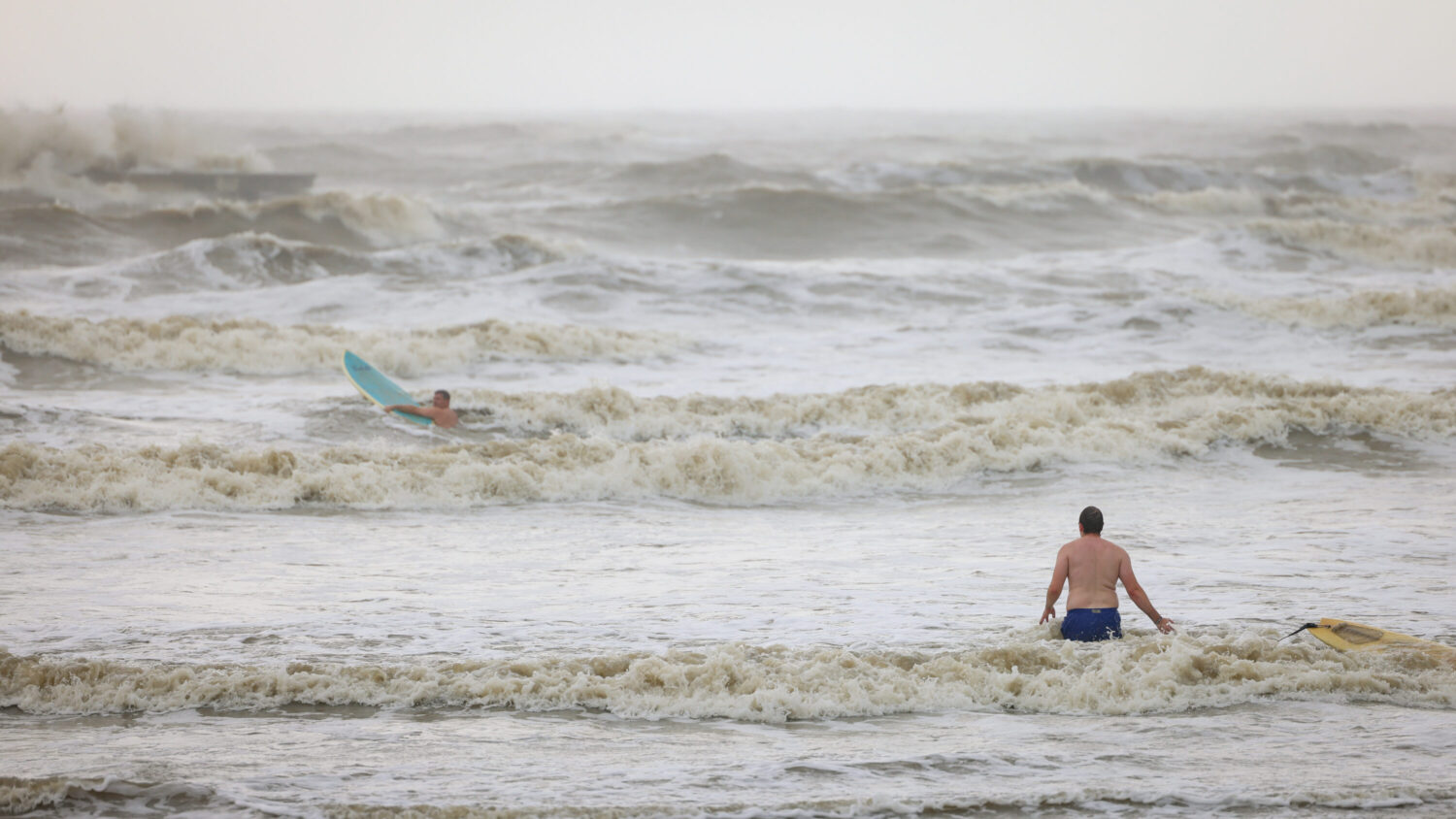
Down in Galveston, red flags blown by strong winds were posted up and down the beach near Pleasure Pier, signifying dangerous conditions as jetties were washed over with high water. Some surfers took advantage, like Bradley.
“Any tropical depression or, like, storm is pretty good on the weather,” Bradley said. “I mean you do take a risk, if you’re not an experienced surfer or whatever, just because of the riptides and the different obstacles that are in the water.”
Bradley and his surfing partner Matthew Creighton spent two hours in the water. He said it’s something he looks forward to when a storm blows in, bringing better waves. Galveston beach officials have warned of strong rip tides and other dangerous water conditions associated with the tropical storm.
RELATED: Houston Public Media Hurricane and Tropical Storm Tracker
Tim Cady, a meteorologist with the National Weather Service in Houston, said they’ll be keeping an eye on coastal flooding as high tide approaches Thursday morning.
“When we have these strong onshore winds combined with the high tide, that can result in coastal inundation, particularly in our lower-lying coastal areas,” Cady said.
Landfall in Mexico on Thursday
The center of the storm was expected to reach the northeastern coast of Mexico south of the mouth of the Rio Grande by early Thursday morning.
Michael Brennan, director of the National Oceanic and Atmospheric Administration’s National Hurricane Center, said that winds could get up to 45 mph to 50 mph before the storm makes landfall.
As much as 5 inches to 10 inches of rain was expected in some areas along the Texas coast, with even higher isolated totals possible, Brennan said. He said some higher locations in Mexico could see as much as 20 inches of rain, which could result in mudslides and flash flooding, especially in the states of Tamaulipas, Coahuila and Nuevo Leon.
Spencer Plato and The Associated Press contributed to this report.

Gregory Daniels is your guide to the latest trends, viral sensations, and internet phenomena. With a finger on the pulse of digital culture, he explores what’s trending across social media and pop culture. Gregory enjoys staying ahead of the curve and sharing emerging trends with his readers.