Severe weather threat for the Plains and Midwest
A growing severe weather threat for the Plains and Midwest regions of the United States is causing concern for hail and tornadoes.
Multiple rounds of storms will spread across Iowa on Tuesday, bringing repeated chances for severe weather to the Hawkeye State.
A round of rain passed through central Iowa early on Tuesday morning and by mid-morning one round of severe thunderstorms passed through. Another round of storms, with the highest risk for severe weather, is expected Tuesday afternoon, according to the National Weather Service.
Here are the latest updates (Jump to Severe weather outlook | Radar | Safety tips):
The National Weather Service shared a graphic on social media showing the approximate timing for storms later today.
Thunderstorms will likely start in west Iowa around 2 p.m., making their way to Des Moines and central Iowa around 4 p.m. At 7 p.m., the severe weather will be entering eastern Iowa.
At least three Des Moines metro school districts plan to dismiss classes early on Tuesday due to the threat of more severe storms this afternoon.
- Ankeny Schools: Two hour early out
- Urbandale Community School District: Early dismissal and no half-day preschool
- Southeast Polk Community School District: Two hour early dismissal resulting in no evening preschool or evening activities.
- Waukee Community School District: Two hour early dismissal and after school activities are canceled. The district is still waiting for state guidance regarding state playoff events
Des Moines has received just over an inch and a half of rain since severe weather entered Iowa early on Monday, with 1.07 inches since midnight.
Some locations in the state are nearing three inches of rain since last night. Here are the highest rainfall totals as of 11 a.m Tuesday:
- Harlan: 2.99 inches
- Audubon: 2.95 inches
- Iowa Falls: 2.63 inches
- Waterloo: 2.57 inches
- Decorah: 2.15 inches
- Ankeny: 2.02 inches
More than 7,000 people are without power in Iowa as a result of Tuesday’s storms.
That includes more than 2,200 MidAmerican Energy customers in Altoona, 2,200 in Des Moines and 1,800 West Des Moines. The estimated time of power restoration for those residents ranged from 11:30 a.m. to 3 p.m., according to MidAmerican’s website
More than 1,000 MidAmerican customers in Council Bluffs also lost power, but the current outage has recently reduced to about 860 people. The bulk of customers who lost power are east of Council Bluffs and a MidAmerican crew is in route to repair the power outage.
Another 440 Alliant Energy customers near Dexter were also without power.
At least two roads in Des Moines are closed after a round of severe storms moved through the metro area.
The Des Moines Police Department received a small number of reports of power lines down and tree damage.
There are temporary lane closures at the 3300 block of Grand Avenue and the 3900 block of Urbandale Avenue. No significant damage or injury have been reported as of now, according to DMPD.
The severe thunderstorm warning for parts of the Des Moines metro has been extended until 10:30 a.m. Tuesday.
Dallas County has been dropped from the warning, but it now extends into Jasper County and as far east as Grinnell and as far south as Pella.
Threats include 60 mph winds and quarter-sized hail. The extended warning covers over 349,600 people.
A severe thunderstorm moving through the Des Moines metro produced large hail in the western suburbs.
Waukee experienced hail ranging from the size of a nickel to as big as a quarter, at 9:07 a.m. according to a trained weather sportter. Wind gusts up to 55 mph were also reported.
Much of Dallas and Polk counties are under a severe thunderstorm warning until 9:45 a.m. Tuesday.
Storm sirens began sounding just after 8:40 a.m. in the metro. Cities around Des Moines are at risk of winds up to 70 mph and quarter-sized hail.
The warning covers just north of Ankeny and as far south as Truro. It stretches to Redfield and Winterset in the west and Milo in the east.
Dallas and Polk counties both activate sirens for tornadoes or severe thunderstorms with winds over 70 mph. The warning meets that criteria, unlike a storm on Sunday night that activated the sirens in error.
Sirens do not sound continuously during a warning. They will sound for 3-5 minutes and then pause for 10-15 before repeating. There is not an all-clear sound when a warning expires.
What does the Des Moines, Iowa doppler radar show?
Here’s a look at the current National Weather Service radar loop for central Iowa:
Areas around the Des Moines metro are under a severe thunderstorm warning until 9 a.m. Tuesday.
The warning extends from Dallas Center, down to Winterset and as far west as Adel. Possible threats include winds up to 70 mph and quarter-sized hail.
Just over 34,000 people live within the warning area.
Multiple severe thunderstorm warnings have been issued in eastern Nebraska and western Iowa on Tuesday morning.
A warning issued for Pottawattamie County, home to Council Bluffs, until 7:30 a.m. warned of baseball size hail.
Hail that large is sometimes called “gorilla” hail for its large size and destructive power.
The National Weather Service upgraded the risk of severe weather for most of Iowa. A majority of the state it rated “moderate” risk, a level 4 on a scale of 1-5.
More: How much rain did Des Moines get so far? Here are the rainfall totals for Iowa through Monday morning
Multiple rounds of storms are expected to continue through the morning. But, the strongest storms are expected to arrive in central Iowa between 3 p.m. and 8 p.m. Tuesday.
Damaging winds, hail and flash flooding are the primary threats, according to the NWS. Tornadoes — some strong — are also possible.
More: How do tornadoes form? Explaining the severe weather after dozens of recent Iowa tornadoes
Severe thunderstorm watch in effect for Iowa until 1 p.m.
A large portion of central Iowa extending from the southern border to U.S. Highway 20 is under a severe thunderstorm watch until 1 p.m. Tuesday.
The main threats are ping-pong ball-sized hail and wind gusts that could reach 75 mph. Tornadoes are also possible.
A watch is issued when conditions are favorable for severe weather to develop. They often cover large areas.
Warnings are issued when severe weather is actually happening and Iowans need to take action.
Read more: What’s the difference between a severe weather watch and a warning?
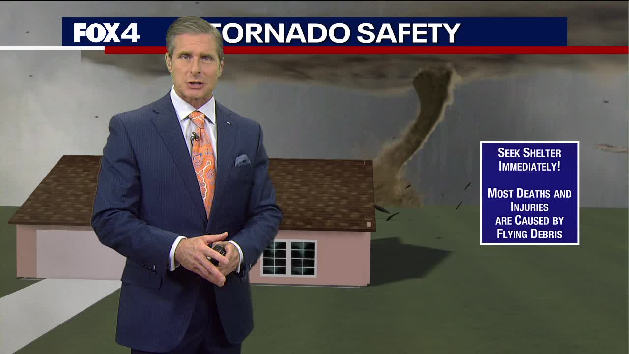
Where is the safest place in your home during a tornado?
Dan Henry has some tips you can take to prepare your family for a tornado.
Fox – 4 News
During a severe weather warning, it’s time to take action and follow your plan.
NWS has tips for what to do at different locations:
- Stay Weather Ready: Continue to follow local news or listen to a NOAA Weather Radio to stay updated about watches and warnings.
- At Your House: Go to your secure location, like the basement or lowest floor level, if you hear a warning. Take your pets with you if time allows.
- At Your Workplace or School: Stay away from windows. Do not go to large open rooms such as cafeterias, gymnasiums or auditoriums.
- Outside: Go inside a sturdy building immediately. Sheds and storage facilities are not safe. Taking shelter under a tree can be deadly.
- In a Vehicle: Being in a vehicle during severe weather is safer than being outside, but, drive to the closest secure shelter if there is sufficient time. Do not stop and park under a bridge or underpass.
Victoria Reyna-Rodriguez is a general assignment reporter for the Register. Reach her at [email protected] or follow her on Twitter @VictoriaReynaR.

Elaine Hadley is a dedicated journalist covering the ever-evolving landscape of U.S. news. With a keen interest in politics and a commitment to uncovering the truth, she provides insightful commentary and in-depth analysis on domestic issues. When not reporting, Elaine enjoys exploring the diverse cultures and landscapes of the United States.


:max_bytes(150000):strip_icc():focal(718x387:720x389)/jin-bts-070224-87004608c3ec4830a9925ecb5c7d103d.jpg)